The Importance of Agility in Emergency Response

Iteris Supports San Francisco Bay Area Metropolitan Transportation Commission’s 511 Emergency Response During NorCal Fires
>> CLICK TO ACCESS FULL WHITE PAPER <<
The Emergency
California has been experiencing very active fire “seasons” the past several years, and 2020 was no different with a season beginning earlier than expected. An unusual weather event composed of uncharacteristic lightning storms struck the San Francisco Bay Area in Northern California, igniting several very large, aggressive wildfires: The LNU Lightning Complex fire, the SCU Lighting Complex fire, and the CZU Lighting Complex fire. These fires affected seven of the nine Bay Area counties by varying degrees, impacting up to 80% of Bay Area residents.
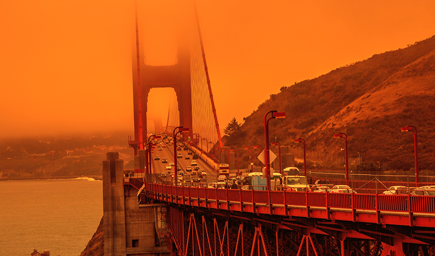
Smoke from northern California wildfires turn the sky orange as cars cross the San Francisco Golden Gate Bridge from Lime Point.
What Happened
As these fires spread in several counties, the 511 SF Bay operation, which is historically a primary source for transportation information in the region’s nine counties, began to ramp up messaging related to the various fires, including road closures. This information was pushed to the public via Bay Area’s 511 dissemination channels including: the 511.org website, 511 phone, social media including Twitter, and emergency SMS alerts. The need for this operation’s important messaging continued to grow as the fire spread escalated and began to impact more densely populated areas, including portions of Interstate 80 and multiple state roadways.
To provide the most accurate and timely information, 511 SF Bay’s operation began the arduous process of compiling road closure information from the various agencies around the Bay Area, in addition to the normal traffic and transit information that is typically shared via the 511 traveler information system. This includes, but is not limited to: reviewing California Highway Patrol (CHP) websites, maps and Twitter feeds for updated closure information; reviewing various county road closure geographic information system, or GIS, maps; reviewing County-disseminated Nixle alerts; reviewing the Twitter feeds of the various Cal Fire command units; communicating with Caltrans Transportation Management Center (TMC) staff regarding closures; and, of course, disseminating all of this information in a timely manner to the public via the 511 dissemination channels.

As the fires grew and road closures began to grow exponentially, the operation increased staffing and coverage of the program on extended schedule from 4:00 a.m. to midnight seven days a week (normal operations are 5:00 a.m. to 9:00 p.m. on weekdays, and 10:00 a.m. to 6:00 p.m. on weekends). Without this additional staffing, it would not have been impossible for all of the necessary information, which was constantly updated, to be validated and disseminated while also maintaining the regular traffic and transit incident monitoring. This was Iteris’ cue to jump in and augment the 511 team.
Key Takeaway
To best prepare for an emergency like this, agencies should establish a communication protocol for sharing important transportation-related information with the public. Tools like 511 systems, GIS maps, Nixle alerts, and Twitter are very effective ways to disseminate roadway information and safety information for users. Agencies should also consider coordination among partner and surrounding agencies to consolidate and match data sharing strategies, which may make user access to available information that much easier. Further, establishing response mechanisms and tools that are cloud-based allows for agile response to emergencies, which allows the Public to have access to key information when it’s needed most.
Access Our Full Analysis
For our full analysis of the unique challenges MTC faced and how Iteris supported its 511 emergency response, download our white paper.
Please also visit our spotlight on emergency response page, which features resources related to smart mobility solutions for public safety.

 X
(Twitter)
X
(Twitter)
 Facebook
 LinkedIn
 Copy
Link
Copy
Link Email
EmailPost Topics
Related Posts

ITS America 2026: Real Conversations, Real Momentum and What Comes Next

How Agencies are Modernizing Small Intersections